Charting the Unmapped: How Fan Cartographers Are Completing Tolkien's World
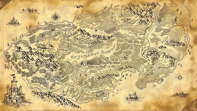
Photo: antique fantasy hand-drawn map parchment cartography detail, via img.freepik.com
Tolkien drew maps the way other writers composed prose—with precision, with purpose, and with a scholar's instinct for the relationship between geography and narrative. The maps he created for The Hobbit and The Lord of the Rings, later refined with his son Christopher, have guided readers through Middle-earth for generations. They are beloved artifacts, as familiar to devoted fans as the stories themselves.
And yet, by design or necessity, they are incomplete. The maps Tolkien published were functional documents, oriented toward the journeys his characters took. They tell us where Rivendell sits in relation to the Misty Mountains, how the Anduin flows toward the sea, where the borders of Mordor are drawn. What they do not tell us—what they were never meant to tell us—is what lies beyond those borders. The lands east of Rhûn, the uncharted southern reaches below Harad, the submerged geography of Númenor, the full expanse of the Undying Lands: these remain, in the official cartographic record, either blank or barely sketched.
For a particular kind of Tolkien enthusiast, that incompleteness is not a limitation. It is an invitation.
The Art and Discipline of Fan Cartography
Fan-made maps of Middle-earth range from rough sketches to works of extraordinary sophistication. At the higher end of the craft, the best fan cartographers combine a deep familiarity with Tolkien's texts—including the appendices, The Silmarillion, Unfinished Tales, and the twelve volumes of The History of Middle-earth—with genuine skill in cartographic design. The results can be genuinely stunning: hand-lettered, aged-parchment renderings of the Undying Lands that feel entirely consistent with Tolkien's aesthetic; speculative reconstructions of Beleriand before its drowning at the end of the First Age; detailed charts of Númenor that extrapolate from the fragmentary descriptions in Akallabêth.
What separates serious fan cartography from casual illustration is the degree of textual rigor involved. A dedicated cartographer working on, say, a map of the Second Age world must reconcile scattered references across multiple sources, some of which contradict one another. Tolkien revised his cosmology several times—most dramatically in the late writings collected in Morgoth's Ring—and those revisions have cartographic implications that require careful interpretation. The work demands the same kind of close reading that literary scholars bring to textual analysis, applied to the practical problem of spatial representation.
The Regions That Captivate Mapmakers Most
Certain unmapped territories have become particular obsessions within the fan cartography community, and it is instructive to consider why.
The Uttermost West holds a special fascination because it is the destination of the most emotionally resonant departure in Tolkien's mythology—the voyage of the Ring-bearers at the end of The Return of the King. We know that Valinor exists beyond the Sundering Seas, that Tol Eressëa lies offshore, that the Pelóri mountains guard the inner lands. But the precise geography of Aman has never been fully rendered, and fan cartographers have produced dozens of competing visions, each drawing on different passages from The Silmarillion and the earlier Book of Lost Tales.
The Sunken Lands of Beleriand present a different kind of challenge. We have Tolkien's own map of the First Age world, but that map shows Beleriand as it existed—not as it was drowned. Reconstructing the post-cataclysm geography of the northwest, matching the surviving coastline to the known topography of the earlier age, has become a beloved puzzle. The resulting maps function almost as geological documents, showing the relationship between the ancient world and the familiar landscape of the Third Age.
The Eastern and Southern Reaches of Middle-earth proper—the vast territories beyond the ken of hobbits and the concerns of the War of the Ring—represent perhaps the richest territory for speculative cartography. Tolkien's texts offer tantalizing fragments: the Sea of Rhûn, the Bay of Belfalas extending southward, the desert kingdoms of the Haradrim. Fan mapmakers have elaborated these fragments into fully realized continents, drawing on both textual inference and the conventions of real-world historical geography.
World-Building Beyond the Map
The most ambitious fan projects do not stop at cartography. They use maps as the foundation for broader acts of world-building—populating their invented territories with languages, histories, climates, and cultures consistent with Tolkien's established framework. In this sense, the best fan cartographers are also, implicitly, fan historians and fan anthropologists.
This kind of integrated world-building reflects something important about the nature of Tolkien's appeal. His legendarium works as well as it does precisely because its geography is inseparable from its history. The shape of Beleriand is the shape of the wars that were fought across it. The position of Mordor relative to Gondor is not arbitrary—it is the physical expression of a theological and moral geography. When fan creators extend the map, they are, consciously or not, extending that logic. The best of them understand that a new territory is not merely a blank space to be filled with invented place-names. It must fit into the larger pattern of meaning that Tolkien established.
Why This Work Matters to the Community
Fan cartography occupies an interesting position within Tolkien fandom more broadly. It is, in one sense, among the most conservative expressions of fan creativity—deeply text-dependent, concerned primarily with consistency and coherence rather than reimagination. And yet it is also genuinely generative, producing new visions of a world that the author left deliberately incomplete.
For many practitioners, the appeal is partly meditative. The careful work of reconciling textual references, drafting coastlines, and placing mountain ranges requires a quality of sustained attention that functions, for some fans, almost as a form of study. It is a way of spending more time in Middle-earth—not passively, as a reader, but actively, as a kind of collaborator.
That collaborative spirit is perhaps the most Tolkien-appropriate thing about it. He conceived of his mythology as a gift to his fellow English speakers, a body of legend that might be added to and elaborated by others. The fan cartographers working today, with their parchment textures and their carefully inked lettering, are doing exactly that—completing, one careful line at a time, the map of a world that was always meant to be larger than any single imagination could contain.